|
(07/03/2024)
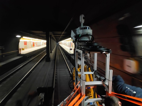
This technology allowed mobile 3D laser scanning with moving devices from the first station on the line, Comasina, to the last station, San Donato. In total, 20 stations on the CM3 line of the Milan Metro and 17 kilometres of track were scanned.
Before carrying out the work on the tracks, a study of the specific needs of the project was conducted to choose the appropriate technology to be used and to decide on the steps to be taken in order to meet the planned deadlines. In a subsequent phase, work began to acquire the points that needed to be detailed using Mobile Mapping technology together with static Lidar laser system.
With both of them, a georeferenced cloud of the entire infrastructure was generated, detailed enough to provide the level of precision needed to optimize the design of the new systems. This point cloud incorporated information on all the signalling, track geometry, safety and marking elements of the metro line tracks. In the next stage, all those data were processed and the lanes and ‘centre lines’ were automatically extracted.

|

